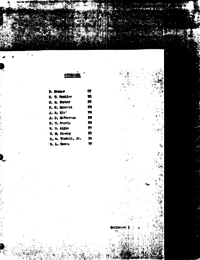
See list belowFEB 21 196868-PA-T-34APA/Chief, Apollo Data Priority CoordinationLandmarks for lunar tracking
1. On February 1 a bunch of us who had been working on operational procedures associated with lunar landmark tracking got together with some of the Lunar Mapping people who have the responsibility for selecting and precisely locating the lunar landmarks to be used. This was a rather refreshing get together since, as strange as it may seem, neither group knew much about what the other was doing in any detail. The thing that prompted the meeting was concern over the recent move to reduce the sun angle lower limit required during the final descent phase of a lunar landing mission.
2. Since the conclusions of this meeting were later presented at an FOP meeting and a subsequent ad hoc panel called by Morris Jenkins, I won't go into them in detail here. I'm sure minutes of those discussions will be much more comprehensive than anything I could write.
3. This note is just to record–for me and you–several items of interest.
a) It was pointed out that when working near the terminator one-half of the view in the telescope will be in sunlight and the other in earthshine which could present some type of a problem to the viewer.
b) It is impossible to use the scanning telescope in earthshine due to its poor light-gathering capability for landmarks of any reasonable size, therefore, the sextant would have to be utilized.
c) The Lunar Mapping people intend to prepare charts which are roughly 30 miles in latitude by 45 miles in longitude with the landing site close to the center. It is anticipated that the relative location from one feature to another will be accurate to the order of 50 meters in latitude and longitude and 200 meters vertically. (These are 1 sigma values.)
d) Each of the landmarks selected will be located within a cluster of larger recognizable landmarks to assist in acquisition. It was emphasized to the Lunar Mapping people that these larger landmarks should be assigned identification and precise coordinates such that, if in real time it is impossible for the crew to find the smaller landmarks, it would be possible for them to observe the larger ones and permit descent targeting even though with somewhat reduced accuracy. Mike Conway (FBD) will coordinate this with Rick Nance to make sure the RTCC is set up to handle them.
e) The Lunar Mapping people felt it preferable to choose landmarks within 3 or 4 miles of the landing site ellipse.
f) It is their goal to provide at least 3 of these clusters per site.
- Jan 10, 1969 – Some decisions regarding lunar landmark tracking on the F and G missions (4.6σ)
- Mar 13, 1968 – Seventh “D” Mission Rendezvous Mission Techniques meeting (4.3σ)
- Dec 15, 1967 – Some lunar landmark tracking questions (3.6σ)
- Jan 11, 1968 – Odds and ends about lunar landmark tracking (3.1σ)


